- Table of Contents
- Introduction
- What is GIS?
- Why is GIS Important in Urban Development?
- 1. Land Use Planning and Zoning
- 2. Infrastructure Development
- 3. Environmental Impact Assessment
- 4. Disaster Management and Urban Resilience
- 5. Smart Cities and Urban Innovation
- 6. Public Participation and Community Engagement
- 7. Urban Growth Monitoring and Policy Making
- 8. Social Equity and Resource Allocation
- 9. Urban Climate Adaptation
- What is Environmental Management?
- The Key Principles of Environmental Management
- 1. Sustainability
- 2. Precautionary Principle
- 3. Polluter Pays Principle
- 4. Integration
- 5. Public Participation
- 6. Biodiversity Conservation
- 7. Continuous Improvement
- 8. Equity and Justice
- 9. Accountability and Transparency
- 10. Preciousness of Ecosystem Services
- Why is Environmental Management Important?
- 1. Preserving Biodiversity
- 2. Sustainable Use of Natural Resources
- 3. Mitigating Climate Change
- 4. Ensuring Public Health
- 5. Supporting Economic Development
- 6. Addressing Global Environmental Challenges
- 7. Protecting Future Generations
- How Does GIS Play an Essential Role in Environmental Management?
- Environmental Monitoring:
- Data Integration:
- Decision Support:
- Land Use Planning:
- Modeling and Forecasting:
- Steps to Apply GIS in Environmental Management
- 1. Define Objectives and Scope
- 2. Data Collection
- 3. Data Preparation and Integration
- 4. Spatial Analysis
- 5. Visualisation and Mapping
- 6. Decision Support
- 7. Implementation of Management Strategies
- 8. Monitoring and Evaluation
- 9. Capacity Building and Training
- 10. Feedback and Continuous Improvement
- Real-World Example
- The Future of GIS in Environmental Management
- 1. Integration with Emerging Technologies
- 2. Advancements in Remote Sensing
- 3. Improved Decision-Making through Real-Time GIS
- 4. GIS in Climate Change Mitigation and Adaptation
- 5. Participatory GIS and Community Involvement
- 6. Enhanced Policy and Governance
- 7. Cloud-Based and Open-Source GIS
- 8. Precision Environmental Management
- 9. Resilience and Sustainability in Urban Ecosystems
- 10. Interdisciplinary Applications
- Conclusion
Introduction
Urbanization, climate change, and the growing need for sustainable development have brought environmental concerns to the forefront of global attention. While these challenges are complex, Geographic Information Systems (GIS) have emerged as a powerful tool for environmental management. This blog post delves into how GIS can be applied in environmental management, its importance in addressing key environmental issues, and how it can support decision-making processes for better sustainability.
We will explore the fundamentals of GIS, its role in urban development, and the principles of environmental management. Additionally, we will examine how GIS integrates with environmental management strategies, the steps involved in its application, and what the future holds for GIS in this field.
What is GIS?
Geographic Information Systems (GIS) is a technology that allows the collection, analysis, and visualization of spatial or geographic data. GIS combines hardware, software, and data to create interactive maps and models that can represent physical environments, including land use, transportation systems, and natural resources. It is a powerful tool for integrating various types of data, ranging from satellite imagery to ground-level observations, and offers insights that can inform planning and decision-making processes.
GIS works by layering data in spatially referenced formats to create maps and models that can reveal patterns, trends, and relationships that would otherwise be difficult to understand. For instance, GIS can map the distribution of wildlife species in a forest, track deforestation rates over time, or visualize the flow of pollutants through rivers.
Why is GIS Important in Urban Development?
Urban development is a multifaceted process involving infrastructure planning, housing, transportation networks, and public services. It must address not only the needs of growing populations but also the sustainability of natural and built environments. Geographic Information Systems (GIS) play a vital role in this process by providing tools for data collection, analysis, and visualization that inform and optimize urban development strategies. Here’s a deeper dive into why GIS is indispensable in urban development:
1. Land Use Planning and Zoning
One of the most significant contributions of GIS in urban development is its ability to map and analyze land use. Urban planners use GIS to identify optimal locations for residential, commercial, industrial, and recreational spaces. For example, GIS can overlay data on population density, transportation networks, and environmental constraints to determine areas best suited for new housing developments while avoiding ecologically sensitive zones.
Zoning regulations, which define how land can be used in specific areas, also benefit from GIS. The technology allows planners to visualize zoning boundaries in relation to existing infrastructure, helping to prevent conflicts such as placing industrial facilities too close to residential neighborhoods.
2. Infrastructure Development
Developing infrastructure like roads, bridges, water supply systems, and electricity networks requires a deep understanding of the geographic and demographic characteristics of an area. GIS assists engineers and planners in designing infrastructure that meets the needs of current and future populations while minimizing environmental impact. For example:
- Transportation Networks: GIS can optimize the placement of roads and public transit systems by analyzing traffic patterns, population distribution, and terrain features.
- Utilities Planning: GIS helps in mapping existing utility lines and planning for future expansions, ensuring that infrastructure can support urban growth.
3. Environmental Impact Assessment
Urban development often encroaches on natural ecosystems, leading to concerns about deforestation, habitat loss, and pollution. GIS is a crucial tool for conducting environmental impact assessments (EIAs). By analyzing data on soil types, vegetation cover, water resources, and wildlife habitats, GIS can help identify potential environmental risks associated with development projects.
For instance, GIS can map flood-prone areas, ensuring that new construction avoids regions vulnerable to water-related disasters. Similarly, it can assess the cumulative impact of urban expansion on local air and water quality, enabling planners to incorporate mitigation strategies.
4. Disaster Management and Urban Resilience
As cities grow, the risk of natural disasters such as floods, earthquakes, and hurricanes increases. GIS plays a critical role in enhancing urban resilience by helping cities prepare for, respond to, and recover from such events. Urban planners use GIS to:
- Map high-risk zones, such as floodplains or earthquake fault lines, to guide safer development.
- Develop emergency response plans that include evacuation routes and locations for shelters.
- Model potential disaster scenarios to understand their impact on urban areas and plan accordingly.
For example, GIS can predict how a flood might spread through a city based on topography and drainage infrastructure, enabling planners to design flood mitigation systems or relocate vulnerable communities.
5. Smart Cities and Urban Innovation
GIS is a cornerstone of the smart city movement, where technology is used to improve urban living standards and optimize resource use. Smart cities leverage GIS to integrate data from sensors, devices, and systems across the urban environment. This real-time data provides insights that can improve city operations, such as:
- Monitoring traffic flow to adjust signals and reduce congestion.
- Managing energy use in buildings to enhance efficiency.
- Tracking waste collection systems to optimize routes and reduce operational costs.
For example, GIS-powered dashboards can display real-time data on air quality, traffic conditions, and public transit schedules, enabling city officials to make informed decisions and residents to access essential information.
6. Public Participation and Community Engagement
Urban development decisions often face scrutiny from the public, particularly when they impact local communities. GIS facilitates transparency and engagement by presenting complex spatial data in easy-to-understand maps and visualizations. Residents can use GIS platforms to view proposed development plans, provide feedback, and suggest alternative solutions.
Public participation is essential for ensuring that development projects address the needs and concerns of the communities they affect. For instance, GIS can be used in participatory mapping exercises, where residents help identify areas of historical or cultural significance that should be preserved during urban expansion.
7. Urban Growth Monitoring and Policy Making
GIS helps governments and policymakers track urban growth and its implications. By analyzing satellite imagery and historical data, GIS can reveal trends in urban sprawl, population density, and land use changes over time. This information is invaluable for shaping policies related to housing, transportation, and environmental protection.
For instance, policymakers can use GIS to identify areas experiencing rapid growth and allocate resources for schools, healthcare facilities, and public transportation. It also supports the enforcement of urban growth boundaries, preventing unchecked sprawl that could harm surrounding agricultural land or natural habitats.
8. Social Equity and Resource Allocation
One of the challenges in urban development is ensuring that resources and services are distributed equitably among all residents. GIS can analyze spatial data to identify disparities in access to essential services, such as healthcare, education, and public transportation. By highlighting underserved areas, GIS helps urban planners allocate resources more effectively and address social inequalities.
For example, GIS can map the distribution of healthcare facilities in a city and compare it with population density to identify areas where additional clinics or hospitals are needed.
9. Urban Climate Adaptation
As climate change accelerates, cities face unique challenges such as rising temperatures, increased rainfall, and more frequent extreme weather events. GIS supports urban adaptation efforts by helping planners design cities that are more resilient to these changes. For example:
- GIS can model urban heat islands to identify areas that require more green spaces or reflective roofing materials to reduce temperatures.
- It can analyze drainage systems to ensure they can handle increased rainfall and prevent urban flooding.
By incorporating climate data into urban planning, GIS helps cities build infrastructure and develop policies that mitigate climate risks.
In short, GIS is not just a tool for mapping; it is a comprehensive platform for analysis, decision-making, and communication that is reshaping how cities are planned and managed. By integrating environmental, social, and economic data, GIS enables urban development that is more sustainable, resilient, and equitable. Whether it's planning infrastructure, assessing environmental impact, or promoting social equity, GIS has become an indispensable ally in the quest for better cities.
What is Environmental Management?
Environmental management is the practice of overseeing and guiding human activities to minimize their impact on the natural environment. This includes the sustainable use of resources, protection of ecosystems, and the prevention of pollution. Environmental management aims to balance the needs of development with the preservation of the planet, ensuring that future generations can thrive in a healthy and sustainable world.
Environmental management covers a wide range of activities, from conserving biodiversity and reducing carbon emissions to waste management and protecting natural resources. The overarching goal is to integrate environmental concerns into decision-making processes at local, regional, and global levels.

As organisations have started including environmental policies and addressing governmental regulations, environmental management systems (EMS) are crucial to improving energy efficiency and environmental sustainability. An environmental management system is the framework used to achieve your environmental goals to help your organisation cut costs, reduce risks,
The Key Principles of Environmental Management
Environmental management is the strategic approach to protecting and sustaining the environment while balancing economic and social needs. It involves applying principles, tools, and practices to ensure that human activities have minimal negative impacts on ecosystems and biodiversity. The foundation of effective environmental management lies in several key principles that guide its implementation. Here’s an in-depth exploration of these principles:
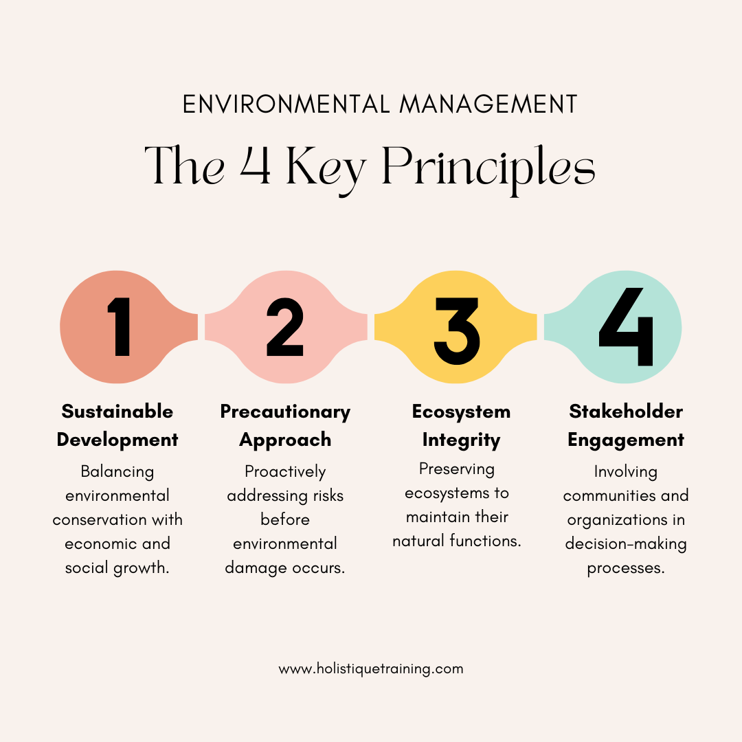
1. Sustainability
At the heart of environmental management is the principle of sustainability, which seeks to meet the needs of the present without compromising the ability of future generations to meet their own needs. This principle emphasizes:
- Resource Conservation: Efficient use and conservation of natural resources, such as water, soil, and minerals, to ensure their availability for the future.
- Eco-Friendly Practices: Promoting renewable energy, reducing waste, and encouraging sustainable agriculture and urban development.
- Holistic Planning: Considering the environmental, social, and economic dimensions of every decision to maintain a balance between development and ecological integrity.
For example, in forestry management, sustainability involves harvesting timber at a rate that allows forest ecosystems to regenerate naturally, preserving their biodiversity and ecosystem services.
2. Precautionary Principle
The precautionary principle emphasizes taking proactive measures to prevent environmental harm, even if some cause-and-effect relationships are not fully established scientifically. It advocates for erring on the side of caution when there is potential for significant or irreversible damage.
For instance:
- If a proposed industrial project might release pollutants into a nearby river, environmental managers might require stringent controls or alternative technologies, even if the exact extent of harm is uncertain.
- In climate policy, the precautionary principle supports taking action to reduce greenhouse gas emissions, despite uncertainties in predicting long-term climate impacts.
3. Polluter Pays Principle
This principle asserts that those who generate pollution or environmental degradation should bear the costs of managing and mitigating the impacts. It promotes accountability and encourages organizations to adopt cleaner, more sustainable practices to reduce their environmental footprint.
Applications include:
- Carbon Pricing: Companies that emit greenhouse gases are charged a fee, incentivizing investment in renewable energy or cleaner technologies.
- Waste Management Fees: Industries must pay for proper disposal or recycling of hazardous waste, discouraging improper dumping.
By internalizing environmental costs, the polluter pays principle fosters more responsible corporate behavior and reduces the burden on governments and taxpayers.
4. Integration
Environmental management is most effective when integrated into broader economic, social, and political frameworks. The integration principle ensures that environmental considerations are not treated as standalone issues but are embedded into decision-making processes across various sectors.
Examples of integration include:
- Urban Planning: Designing cities with green spaces, sustainable transport systems, and efficient energy use.
- Agricultural Policies: Incorporating soil health and water conservation into farming practices to ensure long-term productivity.
- Corporate Strategy: Encouraging businesses to include environmental performance as a key metric in their operations and reporting.
Integration promotes a systems-thinking approach, recognizing the interconnections between human activities and natural ecosystems.
5. Public Participation
Inclusive decision-making is a cornerstone of environmental management. Engaging stakeholders, including local communities, businesses, and non-governmental organizations, ensures that diverse perspectives are considered and that solutions are equitable and practical.
Benefits of public participation:
- Informed Decision-Making: Communities can provide valuable insights about local environmental issues and cultural priorities.
- Transparency: Open dialogue builds trust and reduces resistance to environmental policies or projects.
- Shared Responsibility: Public involvement fosters a sense of ownership, encouraging individuals and organizations to contribute to environmental protection.
For example, participatory rural appraisals (PRAs) involve local residents in identifying environmental challenges and co-creating solutions, such as community-led afforestation projects.
6. Biodiversity Conservation
Protecting biodiversity—the variety of life on Earth—is a critical principle in environmental management. Biodiversity supports ecosystem services such as pollination, water purification, and climate regulation, which are essential for human survival.
Environmental management strategies for biodiversity conservation include:
- Protected Areas: Establishing national parks, wildlife reserves, and marine sanctuaries to safeguard habitats.
- Habitat Restoration: Rehabilitating degraded ecosystems to support native species and improve ecological balance.
- Legislation: Enforcing laws against illegal hunting, logging, and trade in endangered species.
Promoting biodiversity also involves educating communities about its value and encouraging sustainable practices that minimize habitat destruction.
7. Continuous Improvement
Environmental management is an ongoing process that requires regular evaluation, feedback, and adaptation. The principle of continuous improvement emphasizes learning from past experiences and adopting innovative solutions to address emerging challenges.
Key aspects of this principle include:
- Monitoring and Evaluation: Tracking environmental indicators, such as air and water quality, to measure progress and identify areas needing improvement.
- Adopting New Technologies: Utilizing advancements in renewable energy, waste treatment, and environmental monitoring to enhance efficiency.
- Adaptive Management: Adjusting strategies based on changing circumstances, such as new scientific findings or shifts in climate patterns.
For example, industries may adopt ISO 14001 , an international standard for environmental management systems, to continually refine their environmental performance.
8. Equity and Justice
Environmental management must ensure fair distribution of resources and benefits while addressing the disproportionate impacts of environmental degradation on vulnerable populations. This principle highlights the importance of social equity in achieving environmental sustainability.
Applications include:
- Access to Clean Resources: Ensuring all communities, especially marginalized groups, have access to clean water, air, and energy.
- Climate Justice: Addressing the unequal effects of climate change on developing nations, which often face the greatest risks despite contributing least to greenhouse gas emissions.
Environmental justice movements advocate for policies and practices that prevent exploitation of natural resources in ways that harm underprivileged communities.
9. Accountability and Transparency
Environmental management thrives on accountability—ensuring that individuals, organizations, and governments adhere to environmental regulations and commitments. Transparency in actions, policies, and data builds public trust and supports effective governance.
For example:
- Corporations report their environmental impact through sustainability disclosures, allowing stakeholders to assess their commitment to reducing carbon footprints.
- Governments maintain public access to information about environmental laws, projects, and outcomes, enabling citizens to hold authorities accountable.
10. Preciousness of Ecosystem Services
Recognizing and valuing ecosystem services—such as pollination, carbon sequestration, and water filtration—is a fundamental principle. Environmental management seeks to preserve these services by maintaining the health of ecosystems.
This principle underpins efforts to:
- Reduce deforestation, which disrupts carbon sequestration and climate regulation.
- Conserve wetlands, which act as natural water purifiers and buffers against flooding.
- Protect pollinators, essential for food security through agricultural productivity.
The principles of environmental management are interconnected, forming a comprehensive framework for protecting the environment while supporting human development. These principles guide governments, organizations, and individuals in making informed decisions that prioritize ecological health, equity, and sustainability. By adhering to these principles, we can build a future where economic growth and environmental stewardship go hand in hand.
Table: Key Performance Indicators (KPIs) of Environmental Management
KPI | Description |
Carbon Footprint | Total greenhouse gas emissions from operations. |
Waste Reduction | Percentage decrease in waste generated annually. |
Energy Efficiency | Reduction in energy use per output unit. |
Water Usage | Amount of water consumed versus conserved. |
Biodiversity Protection | Increase in preserved or restored natural habitats. |
Why is Environmental Management Important?
Environmental management is crucial for the well-being of both the planet and humanity. As ecosystems face increasing pressure from urbanization, industrialization, and climate change, effective environmental management ensures that natural resources are preserved and ecosystems remain resilient. Here is a detailed exploration of why environmental management is a necessity:
1. Preserving Biodiversity
Biodiversity, the variety of life on Earth, is essential for maintaining ecological balance. Environmental management plays a pivotal role in:
- Protecting Endangered Species: By identifying critical habitats and implementing conservation strategies, environmental management prevents species extinction.
- Maintaining Ecosystem Services: Healthy ecosystems provide vital services like pollination, water filtration, and carbon storage, which are essential for human survival.
For example, managing wetlands ensures habitats for migratory birds while also acting as natural water filters.
2. Sustainable Use of Natural Resources
Natural resources, including water, forests, and minerals, are finite. Overexploitation can lead to resource depletion and environmental degradation. Environmental management promotes:
- Efficient Resource Use: By encouraging practices like sustainable forestry and water conservation, resources are utilized responsibly.
- Long-Term Availability: Proper management ensures that future generations have access to essential natural resources.
For instance, sustainable fishing practices help maintain fish populations, supporting both marine ecosystems and the livelihoods of fishing communities.
3. Mitigating Climate Change
Climate change poses one of the greatest threats to global stability. Environmental management is critical in addressing this challenge by:
- Reducing Greenhouse Gas Emissions: Initiatives such as reforestation, renewable energy adoption, and sustainable transportation mitigate carbon emissions.
- Adapting to Climate Impacts: Strategies like building climate-resilient infrastructure and protecting coastal zones reduce the adverse effects of rising sea levels and extreme weather events.
For example, reforesting degraded lands not only captures carbon but also restores soil health and water cycles.
4. Ensuring Public Health
Environmental degradation has direct implications for human health, as polluted air, water, and soil contribute to diseases and reduced quality of life. Environmental management safeguards public health by:
- Controlling Pollution: Implementing policies to reduce industrial emissions, manage waste, and protect water bodies ensures cleaner environments.
- Promoting Healthy Living Conditions: Urban planning that incorporates green spaces and monitors air quality contributes to healthier communities.
For example, managing industrial effluents prevents waterborne diseases in communities reliant on nearby rivers for drinking water.
5. Supporting Economic Development
While environmental conservation might seem at odds with economic growth, it is, in fact, a driver of sustainable development. Environmental management contributes by:
- Boosting Green Industries: Investments in renewable energy, ecotourism, and sustainable agriculture create jobs while protecting the environment.
- Preventing Economic Losses: By mitigating disasters like floods, droughts, and soil erosion, effective management reduces the costs associated with environmental damage.
For instance, mangrove conservation not only supports biodiversity but also shields coastal communities from storm surges, reducing disaster recovery costs.
6. Addressing Global Environmental Challenges
Environmental issues such as deforestation, plastic pollution, and loss of biodiversity require coordinated efforts. Environmental management provides a framework to:
- Foster International Collaboration: Agreements like the Paris Accord depend on robust environmental management practices for implementation.
- Achieve Global Sustainability Goals: Environmental management aligns with the United Nations’ Sustainable Development Goals (SDGs), particularly those focused on clean water, climate action, and life on land.
By addressing these global challenges, environmental management contributes to a healthier, more equitable planet.
7. Protecting Future Generations
Environmental management is not just about addressing current issues but ensuring a sustainable legacy for the future. This involves:
- Educating Communities: Raising awareness about environmental issues inspires individuals and organizations to adopt sustainable practices.
- Planning for the Long Term: Strategic management ensures that natural resources and ecosystems are preserved for generations to come.
For example, reintroducing native plant species in degraded landscapes creates a lasting positive impact on biodiversity and community livelihoods.
The importance of environmental management cannot be overstated. It underpins the health of ecosystems, the sustainability of natural resources, and the well-being of human societies. By balancing conservation and development, environmental management not only addresses current environmental crises but also secures a sustainable future for all life on Earth.
How Does GIS Play an Essential Role in Environmental Management?
Geographic Information Systems offer a unique ability to analyze and visualize geographic data, making them an essential tool in environmental management. GIS enables professionals to collect, interpret, and display data related to environmental conditions and resources. This functionality is particularly valuable in areas such as land conservation, pollution monitoring, natural resource management, and urban planning.
Environmental Monitoring:
GIS allows environmental managers to track and monitor environmental conditions over time. For instance, GIS can be used to monitor air quality, track deforestation, or map the spread of invasive species. Real-time data can be integrated into GIS, providing instant insights that can inform rapid responses to environmental issues.
Data Integration:
One of GIS’s greatest strengths is its ability to integrate diverse types of data. Environmental management often requires the combination of multiple data sources, such as satellite imagery, environmental sensors, and field observations. GIS makes it easier to integrate and analyze these datasets in a single platform, enabling more accurate assessments.
Decision Support:
GIS helps decision-makers by providing spatial insights into how different actions might impact the environment. For example, GIS can help urban planners evaluate the potential impact of new infrastructure on local ecosystems or assess the best locations for renewable energy installations.
Land Use Planning:
GIS is instrumental in land use planning, helping identify areas that are suitable for development, conservation, or restoration. It can also help identify vulnerable areas prone to natural disasters, such as flood zones, which require special consideration during urban planning.
Modeling and Forecasting:
GIS can be used to model environmental processes, such as water flow, pollutant dispersion, or land-use changes. These models can help forecast future environmental scenarios and inform decision-making for long-term sustainability.
Steps to Apply GIS in Environmental Management
The application of Geographic Information Systems (GIS) in environmental management involves a systematic process that integrates spatial data with analytical tools to assess, monitor, and address environmental issues effectively. Here’s a detailed breakdown of the steps involved:
1. Define Objectives and Scope
The first step in applying GIS is to clearly define the goals of the environmental management project and its scope. This involves:
- Identifying the Problem: Determine the specific environmental issue to be addressed, such as deforestation, pollution, or natural disaster risk.
- Setting Goals: Establish measurable objectives, such as reducing carbon emissions, protecting biodiversity, or planning sustainable land use.
- Understanding Stakeholder Needs: Engage with stakeholders, including government agencies, communities, and environmental organizations, to ensure their priorities are reflected in the project scope.
For instance, if the objective is to monitor urban air quality, the scope might focus on mapping industrial zones, transportation corridors, and residential areas.
2. Data Collection
GIS requires high-quality spatial data to generate accurate and meaningful results. Data collection involves:
- Primary Data Acquisition: Gathering field data using tools like GPS devices, drones, and remote sensing technologies.
- Secondary Data Sources: Accessing existing datasets, such as satellite imagery, topographic maps, and environmental statistics from governmental or international agencies.
- Multidimensional Data: Including environmental variables like temperature, precipitation, vegetation cover, and pollution levels.
For example, monitoring deforestation might involve acquiring satellite images to detect changes in forest cover over time.
3. Data Preparation and Integration
Once collected, raw data must be processed and integrated into the GIS system. This step includes:
- Data Cleaning: Removing errors, duplicates, and inconsistencies to ensure accuracy.
- Georeferencing: Aligning the data to a geographic coordinate system to standardize spatial references.
- Layer Creation: Organizing data into thematic layers, such as land use, water resources, and biodiversity, for better visualization and analysis.
- Attribute Data Integration: Linking spatial data with descriptive information, such as pollution levels at specific locations or species diversity in different habitats.
In projects addressing water quality, for example, layers might include rivers, land use, industrial sites, and water sampling points.
4. Spatial Analysis
GIS excels in analyzing spatial relationships, patterns, and trends. Depending on the objectives, various analytical methods can be employed:
- Overlay Analysis: Combining multiple data layers to understand interactions, such as how industrial zones overlap with sensitive ecosystems.
- Proximity Analysis: Measuring distances, such as the proximity of polluting industries to residential areas.
- Hotspot Analysis: Identifying areas of high intensity, like regions with elevated pollution levels or high biodiversity loss.
- Temporal Analysis: Examining changes over time, such as urban sprawl or desertification trends.
For instance, to manage wildfire risks, spatial analysis might involve overlaying vegetation density, weather conditions, and historical fire locations.
5. Visualisation and Mapping
GIS enables the creation of detailed maps and visualizations that communicate complex environmental data in an accessible format. Key tasks include:
- Thematic Mapping: Designing maps that focus on specific issues, such as air quality, soil erosion, or wildlife habitats.
- 3D Visualization: Representing terrain, buildings, and ecosystems in three dimensions for enhanced understanding.
- Interactive Dashboards: Developing dynamic tools that allow users to explore data layers and scenarios interactively.
For example, flood risk management projects might involve creating floodplain maps that illustrate areas at varying levels of risk under different rainfall scenarios.
6. Decision Support
GIS serves as a powerful decision-support tool by providing insights that inform policy-making and management strategies. This step involves:
- Scenario Modeling: Simulating the outcomes of various actions, such as reforestation or construction of green infrastructure.
- Impact Assessment: Evaluating the potential environmental and social impacts of proposed projects or policies.
- Resource Allocation: Prioritizing areas for intervention, such as regions requiring immediate conservation efforts or disaster response.
For instance, urban planners can use GIS to evaluate how expanding green spaces could mitigate urban heat islands and improve air quality.
7. Implementation of Management Strategies
Using insights derived from GIS, environmental management strategies can be implemented effectively. This includes:
- Conservation Efforts: Establishing protected areas, wildlife corridors, and reforestation programs.
- Pollution Control Measures: Monitoring emissions, identifying pollution sources, and enforcing regulations.
- Sustainable Development Planning: Designing urban layouts, transportation systems, and industrial zones with minimal environmental impact.
For example, GIS might guide the placement of renewable energy installations, ensuring they are situated in optimal locations for solar or wind resources without disrupting ecosystems.
8. Monitoring and Evaluation
Continuous monitoring is crucial to assess the effectiveness of environmental management strategies. GIS facilitates:
- Real-Time Monitoring: Using satellite imagery and IoT devices to track changes in environmental conditions.
- Progress Evaluation: Comparing current data with baseline conditions to measure success.
- Adaptive Management: Updating strategies based on new data, challenges, or technological advancements.
In climate change mitigation, for instance, GIS can track carbon sequestration in reforested areas and evaluate whether targets are being met.
9. Capacity Building and Training
Implementing GIS in environmental management requires building the technical capacity of the workforce. This step involves:
- Training Programs: Educating staff and stakeholders on GIS tools, techniques, and applications.
- Knowledge Sharing: Collaborating with academic institutions, NGOs, and governmental bodies to exchange expertise.
- Community Involvement: Empowering local communities to use GIS for grassroots environmental monitoring and decision-making.
For example, farmers in developing countries might receive training to use GIS-based apps for sustainable water and land management.
10. Feedback and Continuous Improvement
Environmental challenges are dynamic, requiring a flexible approach. Incorporating feedback and refining GIS applications is essential to keep up with evolving needs:
- Stakeholder Feedback: Engaging with stakeholders to understand the practical challenges and opportunities of implemented strategies.
- Technological Upgrades: Adopting new GIS software, hardware, and analytical methods to enhance efficiency.
- Iterative Refinement: Revisiting earlier steps to integrate updated data or revise strategies based on outcomes.
Real-World Example
A coastal city applying GIS for climate resilience might follow these steps to map vulnerable areas, model storm surge scenarios, and design adaptive infrastructure like seawalls and wetlands.
By systematically following these steps, GIS empowers environmental managers to make informed, data-driven decisions that balance development needs with ecological preservation. This structured approach not only addresses current challenges but also builds resilience for future environmental uncertainties.
Table: Metrics to measure the effectiveness of applying GIS in environmental management
Metric | Description |
Accuracy of Spatial Data | Precision of collected and analysed geographic data. |
Resource Monitoring Rates | Frequency of updates on natural resource changes. |
Risk Assessment Success | Effectiveness in predicting and mitigating risks. |
User Accessibility | Ease of GIS tool adoption by stakeholders. |
Decision-Making Efficiency | Speed and accuracy of planning using GIS insights. |

This comprehensive course offers an in-depth exploration of Geographic Information Systems (GIS), focusing on their application in sustainable development. Over five days, participants will gain expertise in GIS tools and techniques, enabling them to analyse spatial data effectively and make informed decisions to promote sustainability. The course
The Future of GIS in Environmental Management
As the world grapples with escalating environmental challenges, Geographic Information Systems (GIS) are poised to play an even more transformative role. Advancements in technology, data availability, and computational power are reshaping how GIS is used to address environmental issues. Here’s a detailed exploration of how GIS is expected to evolve and influence the future of environmental management.
1. Integration with Emerging Technologies
GIS is increasingly being integrated with cutting-edge technologies, amplifying its capabilities and applications in environmental management.
- Artificial Intelligence (AI) and Machine Learning:
AI-driven GIS systems can analyze massive datasets, identify patterns, and predict environmental trends with remarkable accuracy. For instance, machine learning algorithms could forecast deforestation hotspots or predict flood risks based on climate models. - Internet of Things (IoT):
IoT devices, such as sensors and drones, provide real-time environmental data that can be seamlessly incorporated into GIS platforms. These devices can monitor air and water quality, track wildlife movements, and detect changes in soil health, offering timely insights for environmental management. - Big Data Analytics:
The growing availability of environmental data, from satellites, sensors, and crowdsourcing, will require advanced analytical tools. GIS systems will leverage big data analytics to process and visualize complex datasets, uncovering deeper insights into environmental processes. - Augmented and Virtual Reality (AR/VR):
GIS integrated with AR/VR technologies will allow stakeholders to immerse themselves in simulated environments, making it easier to understand and plan for environmental scenarios such as urban flooding or habitat restoration.
2. Advancements in Remote Sensing
Remote sensing technology, which provides high-resolution spatial data, is evolving rapidly.
- Higher-Resolution Satellites: Upcoming satellite missions will offer unprecedented spatial and temporal resolution, enabling detailed monitoring of environmental changes at a global scale.
- Hyperspectral Imaging: This technology captures a broader range of wavelengths, helping detect subtle changes in vegetation health, soil composition, or water quality.
- Unmanned Aerial Vehicles (UAVs): Drones equipped with remote sensing tools will offer flexible, cost-effective solutions for local-scale environmental assessments, such as mapping wetlands or monitoring illegal mining activities.
3. Improved Decision-Making through Real-Time GIS
Real-time GIS applications are set to revolutionize environmental management by providing instant data updates. This capability will:
- Enhance Disaster Response: GIS systems will enable real-time tracking of wildfires, hurricanes, and other natural disasters, helping authorities respond quickly and efficiently.
- Improve Resource Management: Real-time monitoring of water resources, agricultural yields, and urban heat islands will support adaptive management strategies.
- Facilitate Dynamic Conservation Efforts: Conservationists can track wildlife migrations in real-time, ensuring interventions are timely and effective.
4. GIS in Climate Change Mitigation and Adaptation
Climate change is one of the most pressing environmental challenges, and GIS will play a central role in both mitigation and adaptation strategies.
- Carbon Sequestration Mapping: GIS will identify and monitor areas suitable for reforestation and carbon storage.
- Climate Vulnerability Assessments: Advanced GIS models will help predict the impacts of rising sea levels, extreme weather events, and temperature changes on ecosystems and human settlements.
- Renewable Energy Planning: GIS will aid in selecting optimal locations for solar farms, wind turbines, and hydropower projects, minimizing environmental disruption while maximizing efficiency.
5. Participatory GIS and Community Involvement
The democratization of GIS technology is making it more accessible to non-experts, fostering greater community involvement in environmental management.
- Citizen Science Projects: Communities can contribute to data collection efforts, such as monitoring local water quality or reporting illegal logging, using GIS-enabled mobile applications.
- Public Awareness Campaigns: Interactive GIS platforms will engage the public by visualizing environmental challenges and solutions, inspiring collective action.
- Collaborative Decision-Making: Participatory GIS tools will empower communities to contribute to land-use planning and conservation strategies, ensuring inclusivity and local relevance.
6. Enhanced Policy and Governance
GIS will increasingly inform policymaking and governance by providing robust, evidence-based insights.
- Regulatory Compliance: Governments will use GIS to monitor compliance with environmental regulations, such as emission limits or protected area boundaries.
- Sustainability Reporting: GIS tools will help organizations track and report their environmental footprints, aligning with global sustainability standards like the UN’s Sustainable Development Goals (SDGs).
- Cross-Border Collaboration: GIS platforms will facilitate international cooperation on transboundary environmental issues, such as river basin management or migratory species conservation.
7. Cloud-Based and Open-Source GIS
The shift towards cloud computing and open-source platforms will make GIS more accessible, scalable, and collaborative.
- Cloud-Based GIS Solutions: These will enable real-time data sharing and analysis across geographies, reducing the need for expensive local infrastructure.
- Open-Source Platforms: Open-source GIS tools will encourage innovation, lower costs, and increase adoption, especially in developing regions with limited resources.
- Global Data Repositories: Collaborative initiatives will provide open access to environmental datasets, empowering researchers, policymakers, and activists worldwide.
8. Precision Environmental Management
With GIS becoming more sophisticated, precision approaches to environmental management will gain prominence.
- Precision Agriculture: GIS will optimize resource use in farming, reducing environmental impacts while maximizing productivity.
- Targeted Conservation: GIS will identify critical habitats and prioritise them for conservation efforts, ensuring efficient use of resources.
- Tailored Urban Planning: Urban planners will leverage GIS to design sustainable cities that balance growth with ecological preservation.
9. Resilience and Sustainability in Urban Ecosystems
GIS will be instrumental in building resilient and sustainable urban environments.
- Green Infrastructure Planning: GIS will guide the design of parks, green roofs, and other infrastructure that mitigates urban heat and enhances biodiversity.
- Smart Cities: GIS-integrated smart city initiatives will monitor energy use, waste management, and air quality, fostering sustainability.
- Disaster Preparedness: Urban GIS systems will assess risks and plan for contingencies, minimizing the impact of natural disasters on urban populations.
10. Interdisciplinary Applications
The future of GIS in environmental management lies in its integration with other disciplines.
- Health and Environment: GIS will map the links between environmental factors and public health, aiding in disease prevention and health promotion.
- Sociocultural Dimensions: Spatial analysis will incorporate social and cultural factors, ensuring that environmental solutions are equitable and context-sensitive.
- Economic Planning: GIS will balance environmental sustainability with economic growth by analyzing trade-offs and synergies.

This advanced course provides an in-depth exploration of integrating AutoCAD and GIS to enhance spatial data management and analysis. Designed for professionals seeking to bridge the gap between CAD and GIS technologies, this course offers hands-on experience and practical skills in leveraging AutoCAD for GIS support. Participants
The future of GIS in environmental management is both promising and transformative. As technology advances, GIS will not only enhance our ability to understand and address environmental challenges but also foster collaboration, innovation, and sustainable development. By integrating GIS with emerging technologies and adopting participatory approaches, humanity can build a resilient, sustainable, and equitable future. GIS is not just a tool for environmental management—it is a cornerstone of global sustainability efforts.
Conclusion
The application of GIS in environmental management is a powerful approach that supports sustainable development and helps manage natural resources more effectively. Through its ability to integrate, analyze, and visualize geographic data, GIS empowers decision-makers to address environmental challenges and improve the health of our planet. As urbanization, climate change, and environmental concerns grow, the role of GIS in environmental management will only become more critical, offering innovative solutions to protect and preserve the world’s ecosystems for generations to come.
To further explore how GIS can transform environmental strategies, our Sustainable Agribusiness and Environmental Management course provides in-depth knowledge and practical tools for addressing today’s pressing challenges. This program is designed to equip learners with cutting-edge GIS skills to drive sustainable practices in agriculture and environmental conservation. Join us to gain expertise in integrating technology with sustainability and lead impactful solutions in environmental management.