Introduction
Geospatial Information Systems (GIS) have become an integral part of modern decision-making processes. This powerful technology allows organisations to analyse, visualise, and interpret spatial data in ways that significantly enhance decision-making in a variety of fields. Whether it's urban planning, environmental management, business strategy, or agriculture, GIS is transforming how decisions are made, offering a more accurate, efficient, and data-driven approach to problem-solving. In this blog post, we will explore the concept of GIS, its importance, its role in urban planning, how it influences decision-making across different sectors, and the future of this technology.
What is GIS Technology?
Geographic Information Systems (GIS) is a technological framework that captures, stores, analyses, manages, and visualises spatial and geographical data. GIS integrates multiple layers of data from different sources, which can be overlaid on a digital map to reveal patterns, relationships, and trends that are not easily noticeable through traditional data analysis methods. This makes GIS a powerful tool for understanding complex spatial relationships and supporting informed decision-making.
At its core, GIS involves the use of mapping software to represent data visually. This data can include anything from topographical maps and satellite imagery to demographic statistics and transportation networks. GIS uses both spatial data (location-based) and attribute data (descriptive information about the location) to generate insights. These insights can then be used to make decisions in sectors like urban planning, environmental conservation, business expansion, and more.
Why is GIS Important?
The importance of GIS lies in its ability to provide a deeper understanding of geographic patterns and processes. By integrating various datasets, GIS allows for real-time analysis and visualisation of information, offering a more comprehensive view of the world. This enhances decision-making in several ways:
1. Data-Driven Decision Making
In an age where data is abundant, the ability to make decisions based on accurate, up-to-date information is crucial. GIS facilitates this by providing a platform where spatial data (such as geographic locations, borders, and physical characteristics) can be combined with attribute data (such as demographic statistics, environmental factors, or infrastructure data). This combination allows for better insight and enables decision-makers to understand complex relationships within the data.
For instance, a government agency looking to allocate resources for healthcare services can use GIS to analyse where the highest concentrations of elderly populations are located. By layering this data with information about the nearest medical facilities, they can make more effective decisions about where to build new clinics or direct mobile healthcare units. This data-driven decision-making is far more efficient than relying solely on intuition or incomplete datasets.
2. Efficiency and Time Savings
GIS is invaluable for improving efficiency. Traditional methods of analysing geographic data often involved manual mapping, calculations, and spreadsheets, which were time-consuming and error-prone. GIS has revolutionised this process by automating many aspects of spatial data analysis. This automation significantly reduces the time spent on data processing and allows users to focus on interpreting results and making decisions.
For example, in urban planning, the use of GIS allows planners to quickly assess land use, zoning, traffic patterns, and environmental conditions. They can analyse and compare these factors almost instantaneously rather than spending days or weeks gathering and processing information manually. This time efficiency allows for more rapid decision-making, ensuring that critical issues are addressed in a timely manner.
3. Visualisation of Complex Data
One of the greatest strengths of GIS is its ability to visualise complex, multi-dimensional data in an accessible format. Maps, charts, and 3D models offer intuitive visual representations of data that can simplify the analysis of complex issues. This visualisation ability allows decision-makers to see spatial relationships and trends that might be difficult to interpret in a spreadsheet or text document.
For instance, urban planners can use GIS to visualise the distribution of green spaces, pollution levels, or traffic congestion across a city. These visual representations make it easier to identify problem areas, such as a region with high levels of air pollution or a neighbourhood in need of public transportation upgrades. The ability to visualise data makes GIS a powerful communication tool, helping convey findings to stakeholders and the general public in a more understandable way.
4. Improved Collaboration and Communication
In many fields, particularly in urban planning, disaster response, and business strategy, multiple stakeholders need to collaborate and share data to make decisions. GIS provides a common platform that can be accessed by different teams, agencies, and organisations, enabling seamless data sharing and collaboration. This is particularly valuable when dealing with large, complex datasets that involve multiple perspectives.
For example, in environmental management, GIS can be used by government agencies, environmental NGOs, and private companies to share data on climate change, land use, and conservation areas. By working together within a shared GIS framework, these stakeholders can create comprehensive, coordinated solutions that are more effective than those devised by isolated groups. The ability to collaborate within a GIS system enhances transparency, fosters cooperation, and ultimately leads to more informed decision-making.
5. Cost Savings and Resource Optimisation
GIS technology allows organisations to optimise the use of their resources, which often leads to significant cost savings. For example, in logistics and supply chain management, GIS can be used to optimise delivery routes, reducing fuel costs and improving efficiency. Similarly, urban planners can use GIS to identify the most cost-effective sites for new infrastructure, such as schools, hospitals, or roads, based on factors like land availability, zoning regulations, and environmental concerns.
In agriculture, GIS can be used to determine the best areas for planting certain crops, based on soil quality, climate conditions, and historical crop yield data. By making decisions informed by GIS, farmers can improve crop yields, reduce waste, and lower costs associated with pesticide use and water consumption.
Additionally, GIS helps organisations avoid costly mistakes. For example, a construction company using GIS can identify potential environmental risks or zoning conflicts before breaking ground, thus preventing expensive delays or rework. By anticipating problems and avoiding inefficiencies, GIS leads to better financial planning and fewer unforeseen expenditures.
6. Sustainability and Environmental Protection
As concerns about climate change, resource depletion, and environmental degradation grow, the need for sustainable decision-making has never been greater. GIS plays a critical role in supporting sustainability efforts by helping organisations understand the environmental impacts of their decisions and plan accordingly.
In conservation, GIS enables environmentalists to track deforestation, monitor biodiversity, and assess the effectiveness of protected areas. By visualising data on ecosystems, endangered species habitats, and pollution levels, GIS helps identify areas in need of protection and prioritise conservation efforts. Similarly, in urban development, GIS helps planners ensure that new developments are sustainable, taking into account factors like flood zones, natural resources, and air quality.
By providing a clear view of the environmental consequences of decisions, GIS enables more responsible and informed approaches to land use, resource management, and environmental conservation.
7. Risk Assessment and Management
Risk management is another area where GIS technology proves its worth. With the ability to map hazards such as floods, earthquakes, wildfires, or political instability, GIS helps decision-makers identify areas that are at higher risk. This information is crucial for risk mitigation strategies, emergency planning, and disaster response.
For example, during natural disasters, GIS can provide real-time data on the affected areas, including infrastructure damage, flood zones, and the movement of people. Emergency responders can use this information to plan evacuation routes, allocate resources, and prioritise aid delivery. GIS also plays a role in long-term risk management by helping governments and businesses understand trends, such as climate change or population growth, that could affect risk levels in the future.
Moreover, in sectors like insurance, GIS allows companies to assess the risk of insuring properties based on geographical factors like flood-prone areas or proximity to active fault lines. By understanding the spatial aspects of risk, businesses can make more accurate predictions and adjust their strategies accordingly.
8. Real-Time Data and Decision-Making
One of the most exciting aspects of GIS is its ability to integrate real-time data from various sources, such as satellites, sensors, and social media. This ability allows decision-makers to make timely and responsive decisions based on current conditions.
For example, in transportation management, GIS can help traffic controllers monitor congestion and accidents in real time, enabling them to adjust traffic signals or suggest alternate routes. In agriculture, sensors embedded in fields can provide real-time information on soil moisture levels, helping farmers adjust irrigation schedules accordingly. Similarly, during a natural disaster, GIS can provide emergency responders with up-to-the-minute information on the location and severity of damage, enabling quicker and more effective responses.
Real-time GIS enhances situational awareness, ensuring that decisions are based on the most current information, which can be the difference between success and failure, particularly in high-stakes situations.
The importance of GIS cannot be overstated, as it empowers decision-makers to take a more informed, efficient, and proactive approach to complex challenges. From urban planning and environmental management to business strategy and disaster response, GIS has a transformative impact on the way decisions are made. By enabling data-driven decisions, improving efficiency, enhancing collaboration, and supporting sustainability, GIS ensures that decisions are based on the best available data, leading to more effective outcomes. As the technology continues to evolve, the potential applications of GIS will expand even further, making it an indispensable tool for organisations in virtually every sector.
What is Urban Planning?
Urban planning refers to the process of designing and organising the use of land, resources, and infrastructure within cities and towns. The goal of urban planning is to ensure that urban spaces are organised and developed in a way that supports economic growth, sustainability, public health, and overall quality of life for residents. Urban planning involves a wide array of considerations, including transportation, zoning, housing, public services, and environmental protection.
Urban planners use a combination of data sources to make decisions about how to allocate land, where to place infrastructure, and how to create spaces that are both functional and aesthetically pleasing. GIS has become an invaluable tool in urban planning, enabling planners to make data-driven decisions that take into account various factors, such as population density, traffic patterns, environmental constraints, and more.
Table: Key Performance Indicators (KPIs) of Urban Planning
KPI | Description |
Land Use Efficiency | Optimising land distribution for maximum utility. |
Infrastructure Quality | Ensuring reliable and sustainable infrastructure. |
Traffic Congestion | Measuring traffic flow and road capacity.. |
Green Space Availability | Evaluating the quantity of parks and nature areas. |
Public Service Accessibility | Access to essential services like healthcare. |
The Benefits of Urban Planning
Urban planning provides several critical benefits to cities and communities:
1. Efficient Use of Space and Resources
One of the primary benefits of urban planning is the efficient use of land and resources. Cities, especially growing urban areas, are often faced with limited space and an increasing population. Without a clear planning strategy, this can lead to overcrowding, unorganised growth, and the depletion of valuable resources.
Urban planning ensures that every inch of space is used optimally. For instance, planners designate specific areas for residential, commercial, industrial, and recreational purposes, ensuring that each area is used in a way that benefits the entire city. In this context, GIS plays a crucial role by helping planners visualise land use, identify underutilised areas, and ensure that growth occurs in the most sustainable way possible.
Additionally, urban planning can help optimise the use of essential resources, like water and energy, by integrating eco-friendly technologies and sustainable infrastructure. For example, planners can ensure that water recycling systems, renewable energy sources, and green building designs are incorporated into new developments, contributing to resource conservation and reducing the environmental footprint of the city.
2. Improved Infrastructure and Transportation
Effective urban planning ensures that infrastructure, such as roads, bridges, public transit, utilities, and communication networks, is well-developed and easily accessible. Without planning, these systems can become disjointed, leading to congestion, inefficiency, and maintenance problems.
For example, cities that implement smart urban planning ensure that roads and public transport systems are strategically aligned to facilitate easy movement. With the right planning, it becomes easier to reduce traffic congestion, improve pedestrian and cyclist pathways, and expand public transportation options like buses, trains, and bike-sharing programs.
Urban planning also contributes to the creation of a well-maintained infrastructure network that supports not just day-to-day activities, but also emergency responses and long-term sustainability. For instance, proper zoning and planning can help ensure that roads are wide enough to handle growing traffic demands, reducing the potential for gridlock.
Furthermore, GIS technology helps urban planners simulate different infrastructure designs and predict traffic flows, making it easier to plan for expansion, changes in population density, and other evolving needs.
3. Enhanced Quality of Life
Urban planning directly impacts the quality of life for residents by shaping the physical environment in which they live, work, and interact. Thoughtful planning can create walkable neighbourhoods, access to green spaces, recreational areas, and vibrant cultural centres—all of which contribute to a higher standard of living.
For example, planning for parks, community centres, and public spaces gives people opportunities to socialise, exercise, and relax. These spaces are particularly important in urban environments where nature and open areas are often limited. Urban planning can also help create safer, more pedestrian-friendly environments, reducing the risk of accidents and enhancing public safety.
Moreover, good urban planning ensures that essential services, such as healthcare, education, and shopping, are accessible to everyone. Mixed-use developments—where residential, commercial, and recreational spaces are integrated into the same area—make it easier for people to access daily necessities without relying heavily on long commutes. This contributes to reducing stress, promoting healthier lifestyles, and fostering a sense of community.
4. Sustainability and Environmental Protection
In the face of climate change, urban planning is a key tool in promoting sustainability and protecting the environment. Well-designed urban areas can minimise the negative impact of development on natural ecosystems, reduce pollution, and conserve energy and water.
For example, urban planners can design cities to reduce urban sprawl, which not only takes up valuable green space but also leads to increased vehicle emissions and energy use. By promoting higher-density development in existing urban areas, planners can help reduce the carbon footprint and preserve surrounding natural habitats.
Urban planning also encourages the integration of green infrastructure, such as rain gardens, permeable pavements, and green roofs, which help mitigate stormwater runoff and reduce the urban heat island effect. These strategies make cities more resilient to the effects of climate change, such as flooding and extreme temperatures.
Through zoning regulations, urban planners can also designate areas as conservation zones, ensuring the protection of wildlife habitats and preserving biodiversity. Additionally, sustainability-focused planning can include the development of renewable energy sources (solar panels, wind turbines) and the promotion of public transit, both of which are vital for reducing the environmental impact of urban areas.
5. Economic Growth and Job Creation
Urban planning plays a central role in promoting economic development. By planning for infrastructure, transportation, and industrial zones, cities can attract businesses, support job creation, and foster innovation.
For instance, urban planners can identify strategic locations for business hubs or tech parks, where businesses can thrive due to proximity to transportation networks, housing, and a skilled labour force. Planning for mixed-use neighbourhoods with commercial spaces also creates opportunities for small businesses to flourish, boosting local economies.
Moreover, the construction and development projects resulting from urban planning create numerous job opportunities, from architects and engineers to construction workers and urban planners. Urban development projects also attract investors and companies, further stimulating economic growth.
Additionally, urban planning can help alleviate poverty by ensuring equitable access to resources, employment opportunities, and essential services. By planning for affordable housing and inclusive neighbourhoods, cities can reduce income inequality and foster economic mobility.
6. Resilience to Natural Disasters and Emergencies
Urban planning plays a critical role in ensuring that cities are resilient in the face of natural disasters such as floods, earthquakes, hurricanes, and wildfires. Cities that are poorly planned may be more vulnerable to damage during these events, leading to loss of life, economic disruption, and long recovery periods.
By anticipating potential risks and integrating disaster risk reduction strategies into urban planning, cities can significantly reduce the impact of such events. For example, planners can design buildings to be more earthquake-resistant, create flood mitigation systems, and ensure that evacuation routes are clearly marked and easily accessible. GIS technology plays a vital role in identifying risk zones, such as flood-prone areas, and guiding planners in making informed decisions about where to build and what infrastructure to prioritise.
Planning for resilience also involves creating post-disaster response strategies, such as building emergency shelters, developing recovery plans, and setting up communication systems that can be activated quickly. By having a proactive urban plan in place, cities are better equipped to manage and recover from natural disasters.
7. Social Equity and Inclusivity
Urban planning plays an important role in promoting social equity by ensuring that all residents have access to the same opportunities, regardless of their socioeconomic status. Proper urban planning ensures that essential services like healthcare, education, and affordable housing are accessible to everyone, including marginalised communities.
For example, urban planners can focus on developing affordable housing in areas that are well-connected by public transportation and close to job opportunities, reducing the need for long commutes. This increases access to economic opportunities for people from different income groups and makes it easier for them to live in safe, healthy environments.
By ensuring that urban planning decisions consider the needs of different population groups—such as low-income families, the elderly, and people with disabilities—cities can become more inclusive and equitable. For example, zoning regulations can ensure that there is a mix of housing types, from single-family homes to high-rise apartments, providing options for different income levels.
8. Long-Term Vision for Growth
Urban planning provides a framework for long-term development, ensuring that cities grow in a way that is sustainable and aligned with future needs. Without a structured plan, cities may develop haphazardly, leading to inefficiencies, environmental degradation, and social inequalities.
By taking into account projected population growth, technological advancements, and changing economic conditions, urban planning helps cities prepare for the future. This includes planning for infrastructure expansion, integrating new technologies, and accommodating the growing demands of residents.
With the help of GIS technology, urban planners can visualise future scenarios, simulate potential growth patterns, and test different development strategies. This long-term vision allows cities to make decisions that not only address immediate needs but also prepare them for the challenges and opportunities of tomorrow.
Urban planning offers a multitude of benefits that are essential for the growth and development of cities. It enhances the quality of life for residents, promotes sustainable resource use, encourages economic growth, and improves resilience to natural disasters. GIS technology plays a central role in ensuring that urban planning decisions are based on accurate, data-driven insights, making it an indispensable tool for creating smarter, more efficient, and more sustainable cities. As cities continue to grow and evolve, the importance of urban planning will only increase, shaping the future of urban life for generations to come.
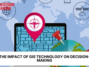
How Does GIS Impact Decision Making?
Geographic Information Systems (GIS) have revolutionised decision-making across various sectors by providing powerful tools to analyse, visualise, and interpret spatial data. By allowing decision-makers to see geographic patterns, relationships, and trends, GIS enables more informed, effective, and data-driven decisions. This is especially critical in areas where location-based factors significantly influence outcomes, such as urban planning, environmental management, business expansion, risk management, agriculture, and beyond. Let’s explore how GIS impacts decision-making in several key fields.
1. Urban Planning and Development
Urban planning involves making complex decisions about how cities and regions should be developed, expanding infrastructure, and managing land use. GIS plays a crucial role in urban planning by providing planners with the spatial analysis tools necessary to make these decisions with greater precision.
With GIS, urban planners can:
- Visualise Land Use : GIS allows planners to visualise existing land use patterns, including residential, commercial, industrial, and recreational zones. This visualisation aids in making decisions about how to best allocate space in a growing city or town.
- Identify Zoning Needs : Planners can analyse how zoning laws align with population density, infrastructure, and the environment, helping to ensure that future developments meet the needs of residents while minimising congestion and environmental degradation.
- Model Future Growth : GIS enables planners to create simulations of future growth patterns based on various factors like population trends, transportation accessibility, and economic development. These models help in identifying the most suitable locations for new developments, public facilities, and housing projects.
- Assess Infrastructure Needs : GIS helps in identifying gaps in infrastructure such as roads, utilities, schools, and healthcare facilities. It can also assist in planning for future infrastructure needs in high-growth areas.
Overall, GIS empowers urban planners to make informed decisions about how cities should grow, ensuring that resources are used efficiently, communities are well-served, and the urban environment remains sustainable.

As cities evolve to meet the demands of growing populations and environmental challenges, the concept of smart cities has emerged as a transformative solution for creating urban environments that are efficient, sustainable, and liveable. This course provides a comprehensive exploration of the design and development
2. Environmental Management
Environmental management often requires making decisions that balance development with conservation, protect ecosystems, and manage natural resources. GIS provides the tools necessary to analyse spatial data related to the environment, which helps decision-makers understand how human activities affect natural systems.
For example, GIS can be used to:
- Monitor Environmental Changes : GIS helps track changes in the environment, such as deforestation, desertification, or changes in land cover. By overlaying data from different time periods, decision-makers can spot trends and assess the impact of human activities or natural events on ecosystems.
- Identify Protected Areas : GIS assists in identifying sensitive areas that require protection, such as wetlands, wildlife habitats, or endangered species’ territories. Decision-makers can make zoning and conservation decisions that minimise human impact on these areas.
- Disaster Risk Management : GIS plays a key role in disaster management by helping governments and organisations predict and respond to environmental disasters such as floods, wildfires, or hurricanes. For example, GIS can map flood-prone areas and help in planning for evacuation routes, disaster response centres, and infrastructure that can withstand such events.
- Sustainable Resource Management : GIS helps monitor natural resources like water, forests, and minerals. It enables resource managers to track usage patterns, evaluate the sustainability of practices, and plan for resource conservation.
Through GIS, environmental management decisions are better informed, allowing for actions that protect ecosystems, conserve resources, and reduce the impact of human activities on the planet.
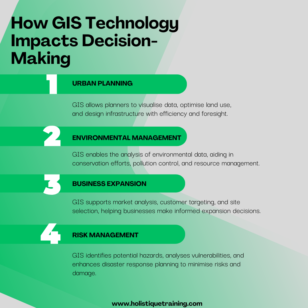
3. Business Expansion and Market Analysis
For businesses looking to expand, understanding market trends and geographical factors can be a game-changer. GIS provides businesses with a deeper understanding of their target markets, customer behaviour, and the competitive landscape, which ultimately informs strategic decisions related to location, marketing, and operations.
Here’s how GIS impacts decision-making in business:
- Site Selection : When businesses look to open new locations or stores, GIS helps them analyse various factors such as population density, income levels, customer demographics, and traffic patterns. By overlaying this data with the location of competitors, businesses can determine optimal site locations that maximise foot traffic and minimise competition.
- Market Segmentation : GIS allows businesses to segment their markets geographically, analysing which areas have the highest concentration of potential customers for their products or services. By visualising these trends, businesses can target their marketing efforts more effectively and efficiently.
- Supply Chain Optimization : GIS is invaluable in the logistics sector, where location-based decisions impact transportation costs, delivery times, and efficiency. With GIS, businesses can map out their supply chain routes, identify the most efficient paths, and optimise warehouse locations to minimise shipping costs.
- Customer Behaviour and Demographics : GIS enables businesses to analyse the demographics of specific geographic regions. This can include understanding consumer preferences, purchasing habits, and socio-economic factors that influence buying decisions. These insights are valuable for tailoring products, services, and marketing campaigns to local tastes.
By integrating GIS into their decision-making processes, businesses gain a significant competitive edge by making data-driven decisions that are closely aligned with geographical trends and market needs.
Geographic Information Systems (GIS) are widely used worldwide to plan safe transportation and understand the risks and effects of road and vehicle enhancements and changes. GIS have helped countless researchers and businesses to design strategic procedures for development and
4. Enhancing Risk Management
Risk management is a critical area where GIS can greatly enhance decision-making by identifying, analysing, and mitigating risks. Whether it’s assessing natural disaster risks, financial exposure, or business vulnerabilities, GIS provides powerful spatial analysis tools to inform these decisions.
Key ways GIS enhances risk management include:
- Natural Hazard Mapping : GIS is commonly used to assess risks associated with natural disasters such as floods, earthquakes, and wildfires. By mapping the location and frequency of these hazards, decision-makers can identify high-risk areas and take steps to mitigate potential damage. For instance, flood-prone areas can be flagged for targeted disaster preparedness, or building regulations can be adjusted to minimise earthquake risks.
- Insurance and Financial Risk : In the financial sector, GIS is used to assess the risk associated with investments, especially real estate and infrastructure. By analysing data on property values, population density, and regional economic factors, insurers and financial institutions can evaluate exposure to risk and make informed underwriting decisions.
- Supply Chain Vulnerabilities : GIS helps companies identify vulnerabilities in their supply chains, such as dependence on certain suppliers or transportation routes that could be disrupted by natural disasters, political instability, or other risks. With this data, businesses can create more resilient supply chains and implement contingency plans to reduce risk exposure.
By integrating GIS into risk management strategies, organisations can better anticipate, evaluate, and mitigate various risks, whether related to natural disasters, economic factors, or business vulnerabilities.
5. Agriculture
GIS technology has made a significant impact on the agricultural industry by improving decision-making related to land use, crop management, and resource allocation. Farmers and agricultural companies can use GIS to enhance crop yields, optimise irrigation, and reduce environmental impacts, among other benefits.
GIS impacts decision-making in agriculture in the following ways:
- Precision Farming : GIS helps farmers collect and analyse data on soil composition, weather patterns, and crop health. With this data, farmers can make informed decisions on how to adjust their planting techniques, irrigation schedules, and fertiliser usage to optimise crop yields and minimise resource waste.
- Climate and Weather Prediction : GIS integrates weather data and climate models to predict weather patterns, helping farmers plan for seasonal variations and extreme events like droughts or heavy rainfall. These insights allow farmers to adjust their planting schedules and water usage accordingly.
- Crop Monitoring : GIS technology is also used to monitor the health of crops through satellite imagery and remote sensing. By identifying areas with pest infestations, nutrient deficiencies, or water stress, farmers can make timely decisions to protect and manage their crops more effectively.
With GIS, agricultural decision-making is no longer based on guesswork. Instead, it’s a precise, data-driven approach that increases efficiency, reduces costs, and promotes sustainability in farming practices.
6. Other Sectors Impacted by GIS
Beyond the aforementioned fields, GIS has a far-reaching impact on decision-making in numerous other industries:
- Finance : GIS aids in market research, fraud detection, and credit risk assessment by analysing geographic patterns in financial transactions and customer behaviours.
- Retail : GIS helps retailers optimise store placements, plan distribution networks, and target advertising to specific customer segments based on geographic data.
- Logistics and Supply Chain : Companies use GIS to streamline logistics, optimising delivery routes and warehouse placement, ultimately reducing transportation costs and improving efficiency.
In short, the impact of GIS on decision-making is profound and multifaceted, touching nearly every sector where spatial data is relevant. From urban planning and environmental management to business expansion and agriculture, GIS allows decision-makers to visualise, analyse, and interpret complex geographic data, making informed, strategic decisions that enhance efficiency, sustainability, and profitability. By incorporating GIS into their decision-making processes, organisations and governments can address challenges more effectively, reduce risks, and create smarter solutions for the future.
The Future of GIS Technology
The future of GIS technology looks incredibly promising, as advancements in machine learning, artificial intelligence, and cloud computing will continue to enhance its capabilities. Some key trends to watch include:
1. Integration of Artificial Intelligence and Machine Learning
One of the most exciting developments in GIS technology is its growing integration with artificial intelligence (AI) and machine learning (ML). These technologies allow GIS to process vast amounts of data with far greater speed and accuracy than traditional methods, making GIS systems smarter and more capable of generating insights autonomously.
- Automated Spatial Analysis : AI and ML algorithms can help GIS systems identify patterns and trends in geographic data that would be nearly impossible for humans to detect. For example, AI-powered GIS tools can automatically detect changes in land use, predict future growth patterns, or identify areas prone to environmental risks without human intervention.
- Predictive Analytics : With the power of machine learning, GIS will be able to provide more accurate predictions based on historical and real-time data. For instance, it could predict traffic congestion patterns, identify areas at risk of flooding, or forecast shifts in agricultural yields. This predictive capability will allow decision-makers to take proactive steps rather than merely react to emerging situations.
- Natural Language Processing (NLP) : Advances in NLP could allow users to interact with GIS systems using everyday language, making GIS more accessible to people without technical expertise. This would open up GIS technology to a broader range of industries, from healthcare to education, enabling non-experts to leverage spatial data in their decision-making processes.
2. Real-Time Data and Internet of Things (IoT) Integration
The proliferation of IoT devices—such as sensors, cameras, GPS trackers, and environmental monitors—is creating an explosion of real-time data that can be integrated into GIS platforms. As more physical objects become "smart" and interconnected, GIS will evolve to process and analyse this flood of real-time information, offering decision-makers an unprecedented level of situational awareness.
- Smart Cities : According to Statista , the global Smart Cities market is anticipated to experience substantial revenue growth, with projections estimating revenues to reach US$72.52 billion by 2024. Furthermore, this growth is expected to persist at a compound annual growth rate (CAGR) of 9.72% from 2024 through 2029 . In the realm of urban planning, GIS will become the backbone of smart city initiatives. Cities equipped with IoT sensors can collect data on everything from traffic flow and air quality to energy consumption and waste management. GIS platforms will integrate this data in real time to provide a holistic view of city operations, helping municipal authorities make decisions to improve efficiency, reduce waste, and enhance the quality of life for residents.
- Environmental Monitoring : In environmental management, real-time data from sensors placed in forests, oceans, or agricultural fields will be analysed through GIS systems to monitor ecological health. For example, real-time weather data combined with environmental sensors could help monitor pollution levels, track climate change impacts, or detect illegal deforestation.
- Disaster Response and Management : Real-time data from IoT devices will significantly improve the way GIS is used in disaster management. In the event of natural disasters like earthquakes, floods, or wildfires, GIS systems can integrate data from drones, satellites, and ground-based sensors to provide up-to-date maps and analysis, helping first responders and decision-makers allocate resources effectively.
This advanced course provides an in-depth exploration of integrating AutoCAD and GIS to enhance spatial data management and analysis. Designed for professionals seeking to bridge the gap between CAD and GIS technologies, this course offers hands-on experience and practical skills in leveraging AutoCAD for GIS support. Participants
3. Cloud Computing and Geographic Data as a Service (GDaaS)
Cloud computing has already transformed how GIS data is stored and accessed, and in the future, GIS will increasingly rely on cloud-based platforms to provide greater flexibility, scalability, and collaboration. As cloud infrastructure evolves, GIS will become more accessible and powerful, enabling users to access high-quality spatial data and analysis tools without the need for expensive on-premise infrastructure.
- Scalability and Cost Efficiency : Cloud platforms allow organisations to scale their GIS capabilities based on demand, eliminating the need for costly investments in physical hardware and IT infrastructure. As GIS data becomes more complex and voluminous, the cloud will provide a more cost-effective and efficient means to store and process it.
- Collaborative Decision-Making : The cloud enables GIS data to be shared and collaborated on in real time. Decision-makers from various departments or even different regions can work together on the same GIS platform, improving the speed and quality of decision-making. For instance, urban planners, environmentalists, and local authorities can all access the same GIS data when making decisions about land use, zoning, and conservation.
- Geographic Data as a Service (GDaaS) : The future of GIS will involve the widespread availability of Geographic Data as a Service (GDaaS), allowing businesses and governments to access specialised datasets on demand. This could include demographic data, environmental datasets, transportation networks, or climate projections. GDaaS will democratise access to high-quality spatial data, allowing organisations of all sizes to benefit from GIS insights without having to manage the data themselves.
4. 3D and Augmented Reality (AR) Integration
One of the most exciting innovations in GIS technology is the integration of 3D modelling and augmented reality (AR). These technologies are transforming how spatial data is visualised and interacted with, opening up new possibilities for decision-making in fields like urban planning, architecture, and tourism.
- 3D City Models : GIS is increasingly being used to create 3D models of cities and landscapes. These models provide a more immersive and realistic view of urban spaces, enabling planners, architects, and engineers to better understand the physical context in which they are working. This can be invaluable in planning new developments, understanding the impact of construction on the surrounding environment, and visualising the effects of proposed changes to a city.
- Virtual Tours and Walkthroughs : GIS-based 3D models combined with AR allow users to "walk through" and interact with spatial data in a virtual environment. For urban planners, this can mean exploring future development projects before they’re built, assessing their potential impact on the community, and refining designs to improve livability.
- Enhanced Public Engagement : AR and 3D GIS models can also help engage the public in urban planning processes by providing a more tangible and accessible way to understand proposed projects. Citizens can view proposed changes to their neighbourhoods in 3D, helping them provide more informed feedback and making the planning process more transparent.
5. Advances in Remote Sensing Technology
Remote sensing technology—especially satellite and drone-based imaging—has already had a profound impact on GIS, but it will continue to evolve rapidly. With new advances in sensor technology, GIS will become even more precise and capable of providing detailed, real-time views of the Earth’s surface.
- Higher Resolution Imagery : Future advancements in satellite and drone technology will provide even higher resolution imagery, allowing GIS systems to capture more granular details about land cover, infrastructure, and environmental changes. This will be particularly useful for applications in agriculture, urban planning, and environmental monitoring.
- Multi-Spectral and Hyperspectral Imaging : New sensor technology will allow GIS systems to analyse a broader spectrum of data, including multi-spectral and hyperspectral imagery. This will improve capabilities in fields such as agriculture (by identifying plant stress), environmental monitoring (by detecting pollutants or contaminants), and disaster management (by tracking changes in real-time).
- Real-Time Remote Sensing : Advances in satellite communication and drone technology will make real-time remote sensing more viable. Real-time data from drones or satellites will allow decision-makers to respond faster to emergencies, plan interventions, and monitor dynamic conditions more effectively.
Future Trend in GIS Technology | Description |
Real-Time Data Integration | Instant access to live spatial data for decisions. |
AI and Machine Learning | Enhancing analysis with automated data processing. |
3D Modelling | Creating realistic, interactive 3D representations. |
Augmented Reality (AR) | Overlaying digital data on physical environments. |
IoT Integration | Using connected devices to gather spatial data. |
6. GIS for Sustainability and Climate Change Action
As global challenges related to sustainability and climate change intensify, GIS will play a crucial role in addressing these issues. Future developments in GIS technology will enhance its ability to support sustainability initiatives by enabling more accurate environmental modelling and informed decision-making.
- Climate Modeling and Impact Assessment : GIS will be increasingly used to model and analyse the impacts of climate change. By integrating spatial data on weather patterns, temperature shifts, sea level rise, and ecosystem changes, GIS will help scientists, policymakers, and communities make more informed decisions about how to mitigate and adapt to climate change.
- Sustainable Urban Development : GIS will continue to assist in designing cities that are more sustainable , resilient, and livable. By analysing environmental impacts, energy usage, and waste management, urban planners will be able to create cities that minimise their ecological footprint and promote sustainability.
- Conservation and Biodiversity Protection : GIS will also be instrumental in the preservation of biodiversity, helping to monitor endangered species, track deforestation, and manage protected areas. GIS technology will help conservationists make better decisions about land use, conservation efforts, and climate adaptation.
In summary, the future of GIS technology is incredibly promising, with innovations in AI, cloud computing, real-time data, remote sensing, and AR transforming how we collect, analyse, and use geographic data. As GIS becomes more integrated into the fabric of decision-making processes, it will enable organisations and governments to make smarter, more informed choices. The result will be a more connected, efficient, and sustainable world—one where the power of location-based data is harnessed to solve some of the most pressing challenges of our time.
Conclusion
GIS technology has revolutionised decision-making across various sectors, enabling more efficient, data-driven choices that improve planning, sustainability, and business operations. From urban development and environmental management to agriculture and business strategy, the applications of GIS are vast and growing. As this technology continues to advance, its potential to influence and enhance decision-making will be even more significant. The future of GIS is bright, and organisations that harness its power today will be better positioned to thrive in tomorrow’s data-driven world. Our course, Geographic Information Systems (GIS) for Sustainable Development , offers a comprehensive understanding of how GIS can be applied to promote sustainability and informed decision-making. By enrolling, you'll gain hands-on experience and the skills needed to leverage GIS technology for real-world solutions. Join us to unlock the potential of GIS and make a lasting impact on sustainable development in your field. Find out more by visiting our website or clicking the link below!

This comprehensive course offers an in-depth exploration of Geographic Information Systems (GIS), focusing on their application in sustainable development. Over five days, participants will gain expertise in GIS tools and techniques, enabling them to analyse spatial data effectively and make informed decisions to promote sustainability. The course